
Mamaroneck Neighbors: Block Sources
The record trail around one address begins with a defined block and the parcels that actually touch it. Westchester GIS supplies parcel geometry, property address, owner name, owner mailing address, SBL, print key, and municipal fields. The Town tax system adds an assessment and owner context. A deed explains title transfers. Historic directories and newspaper material can place a household in an earlier year. Each source answers a different question, and none is a ready-made list of everyone at a house.
| Source | What It Shows About a Block | Access |
|---|---|---|
| Westchester parcel GIS | Adjacent parcels, SBL, property and owner-mailing fields | Free viewer and REST layer; parcel lines are approximate |
| Town tax and assessment records | Owner, mailing contact, tax-map identifier, class and roll year | BAS, PROS, or annual roll archive |
| County Clerk land records | Grantor, grantee, legal description, prior conveyance | WRO index or County Clerk copy route |
| NYS voter lookup | A specific registration confirmation where permitted | Individual lookup; protected records remain shielded |
| Directories and newspaper material | Historic address and household clues | Library, microfilm, catalog, or archival route |
Owner and occupant are different relationships. An owner mailing line can lead to another state, a trustee, a lender, or a representative. A permit may name a contractor or design professional. A voter registration is a distinct status and may be protected. Keep the source and date beside every result before deciding whether it says anything about Mamaroneck neighbors.
Mamaroneck Neighbors and Boundaries
Before opening a parcel, check whether the address is in the unincorporated Town, the Village of Larchmont, or the part of the Village of Mamaroneck west of the Mamaroneck River. The Town's three-part footprint is a practical research issue, not just civic history. A postal address can look like Mamaroneck or Larchmont while the record belongs with a different municipal assessor, permit office, or clerk.
Use the Town parcel layer and, when appropriate, the Village of Mamaroneck layer as a comparison. The County warns that parcel boundaries are approximate. A local tax map and recorded legal description control when the line matters.
Mamaroneck Neighbors Parcel Method
The adjacent-parcel method produces a small, auditable group instead of a vague radius search. In the Town GIS viewer, start on the subject parcel and inspect each touching polygon. Copy the exact property address, SBL, print key, and municipal code. Then check the associated assessment record. The County layer exposes property and owner-mailing fields separately, so it is possible to preserve that distinction instead of treating a mailing contact as an occupant.
- Locate the exact address in the Town and Westchester GIS viewer and confirm its municipality.
- Select only polygons that touch the parcel, then record their address, SBL or print key, and displayed property fields.
- Cross-check each property in the Town BAS tax search using one address, owner name, or tax-map number at a time.
- Use a legal description or deed reference only when the question is title history, not current household membership.
The screenshot below is the Town route to the county GIS system. It leads to parcel research, not a roster of Mamaroneck neighbors.
The Town links residents to the Westchester County GIS route for parcel and boundary research.
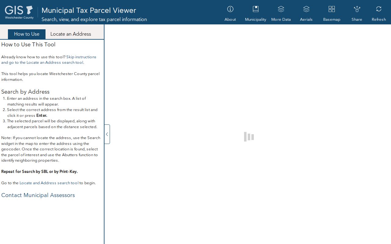
From that starting point, preserve the field values and source date before moving to another record system.
Mapping Mamaroneck Neighbors by Parcel
Property evidence has a clear order of strength. A recorded deed controls title, a municipal tax map and assessment record support taxation work, GIS supports orientation, and a permit records an application or inspection. The same long parcel can face two streets, while a rear lot or shared driveway can make a visual map label misleading. Check geometry, street number, legal description, and permit address together before calling two places adjacent.
For title history, Westchester Records Online is a public index with an account and payment layer for images or reports; the County Clerk keeps the official record. Search the current owner as grantee, retain the instrument and legal description, then follow the prior reference. For a full named-street chain rather than the immediate block, use the Mamaroneck street directory workflow.
Note: Record whether a name is an owner, a mailing contact, an applicant, a grantee, or a historical directory entry before comparing it across a block.
Mamaroneck Neighbors Record Limits
The state voter lookup can help confirm a specific registration record when a researcher has the person's name, county, date of birth, and address. It is not a public browse-by-street tool. Election Law makes registration records inspectable under rules while withholding identifying numbers and protected records. New York's Address Confidentiality Program can substitute a mailing address for qualifying participants, and protected voter status can explain a missing result.
| Official record path | Best use around a block | What not to conclude |
|---|---|---|
| GIS and tax roll | Locate parcels and property-linked owners | Every named owner lives at the parcel |
| WRO deed index | Trace title and legal descriptions | A title holder occupies the home today |
| Voter lookup | Confirm one matching registration record | A public street roster exists or no match proves absence |
| Permit file | Date proposed or approved work | The contractor or applicant is a resident |
New York FOIL can request an existing record, but it does not compel a Town office to assemble a new list of everyone on a street. Ask for a narrow existing file by address, date range, and record type.
Mamaroneck Neighbors Place Networks
Community organizations can provide useful place-history terms without supplying a public roster. Official comprehensive-plan material names the Washington Square Neighborhood Association, Larchmont Gardens Civic Association, and Howell Park Neighborhood Association. Search those names in meeting notices, maps, local history, and community feedback records, but do not infer that a person is a current member or that an address sits within a formal association boundary.
Washington Square
Official planning material identifies the Washington Square Neighborhood Association as a local place-history search term.
Larchmont Gardens
The Larchmont Gardens Civic Association is named in the Town's community-planning material; no current roster was verified.
Howell Park
Town sustainability material identifies Howell Park leadership, while the research found no verified public member directory.
This is a useful distinction: civic names can orient a historical block search, whereas membership and home-address data may be private or unavailable.
Historic Mamaroneck Neighbors
A historic block requires a date. Ask the library or New York State Library for reverse, criss-cross, address, and telephone directories for the exact Town or Village label and year. A criss-cross directory may list an address first; a regular directory may only list the resident by name. Pair any entry with the prior and next available edition, census geography, a Daily Times notice, or deed timing.
The November 1896 Mamaroneck Sanborn map has six sheets that help check building footprints and street geometry. It is a period snapshot, not an ownership record. The Mamaroneck Historical Society's street-name books and historic-map work can help when today’s number or name does not line up with an older entry.
Mamaroneck Neighbors Privacy Limits
Some information is intentionally absent. Driver and vehicle data are restricted under federal law. Protected voter records and Address Confidentiality Program addresses should not be reverse-engineered through relatives, permits, deeds, or maps. A delivery or utility relationship is not an ordinary public resident record. A failed search can reflect confidentiality, sealed material, an unindexed archive, a spelling issue, or the wrong jurisdiction.
Lawful use. Use Mamaroneck neighbors research for personal, lawful purposes such as understanding a block or tracing local history. Do not use public records to watch, harass, threaten, or intimidate anyone.